OSM Maps (Desktop App)
This app is a companion app for the mobile app "„"OSM Maps", though it can also be used standalone.
It shows OSM maps from a selectable source, can set and edit images and notes , add and edit tracks in GPX format, it has grid views of attached images and tracks.
It can synchronize all of that via iCloud or backup files with the mobile app.
There is no tracking, no ads and no data leaves the app without explicit request.
Map View
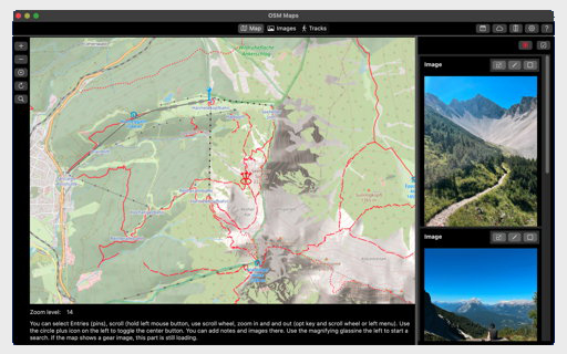
The map view shows maps on the basis of the selected source (see preferences).
It can be scrolled, zoomed, using the mouse or using the plus and minus icons on the right.
On the map items are shown with pin icons in several colors: green for default, red for places including media, blue for track.
If several items are too close, this group is shown with a triple pin icon (purple for media and tracks). You can dissolve it by zooming in.
Clicking on a pin opens the list view of its elements.
Using the detail view you can show item on the map (map icon) or edit them.
Further, you can add notes, photos and videos using the cross in the center of the map. If a photo is add this way, its GPS data is changed to this position.
If the map shows a placeholder (gear image), this part of the map is still loading. You may check this with the refresh button on the right.